Upload presentasi
Presentasi sedang didownload. Silahkan tunggu

1
ATMS 373C.C. Hennon, UNC Asheville Osilasi tropis Osilasi Madden Julian- (MJO)
")
2
ATMS 373C.C. Hennon, UNC Asheville Introduction MJO adalah osilasi intraseasonal Lebih lama dari skala sinoptik (2-5 hari), lebih pendek dari satu musim (~ 90 hari) Umumnya memiliki periode 7-70 hari MJO adalah osilasi intraseasonal utama di daerah tropis Lainnya telah diidentifikasi
, lebih pendek dari satu musim (~ 90 hari) Umumnya memiliki periode 7-70 hari MJO adalah osilasi intraseasonal utama di daerah tropis Lainnya telah diidentifikasi.")
3
ATMS 373C.C. Hennon, UNC Asheville temuan 1970-an: Roland Madden dan Paul Julian (NCAR) menemukan osilasi 40-50 hari dalam angin zonal tropis MJO (seperti yang kemudian dikenal) adalah gelombang merambat timur di atmosfer
 menemukan osilasi hari dalam angin zonal tropis MJO (seperti yang kemudian dikenal) adalah gelombang merambat timur di atmosfer.")
4
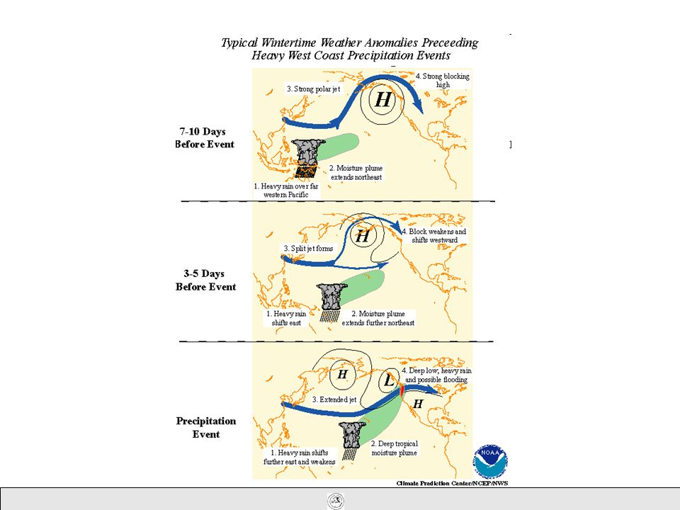
Overview Aktivitas MJO selama bulan Juni-Oktober dan Desember 2004-Januari 2005 menghasilkan variabilitas yang signifikan di atmosfer (angin, tekanan) dan Samudera Pasifik (permukaan dan suhu bawah permukaan). Kegiatan ini dikaitkan dengan periode melemahnya signifikan dari tingkat rendah angin timur di atas Pasifik ekuatorial dan terkait dengan inisiasi timur-laut menyebarkan gelombang Kelvin. Baratan yang terkait dengan area kuasi-stasioner dari konveksi ditingkatkan dekat garis tanggal memprakarsai gelombang Kelvin yang kuat selama akhir Januari 2005. Pada saat ini ada ketidakpastian tentang kemungkinan pengaruh gelombang Kelvin terbaru pada permukaan dan kondisi bawah permukaan di Pasifik ekuatorial bagian timur. Saat ini, MJO tetap sangat lemah. Model prakiraan statistik menunjukkan bahwa aktivitas MJO akan tetap lemah selama periode 6 - 10 hari

5
The Madden-Julian Oscillation (MJO) Madden-Julian Oscillation (MJO) adalah pola perjalanan khatulistiwa curah hujan anomali yang dalam skala planet. Mekanisme dan penyebab MJO adalah saat ini belum dipahami dengan baik dan merupakan subjek penelitian yang sedang berlangsung. Para MJO dicirikan oleh perkembangan ke arah timur daerah besar curah hujan tropis baik ditingkatkan dan ditekan, diamati terutama di atas Samudera Hindia dan Samudera Pasifik. Anomali curah hujan biasanya pertama jelas di atas Samudera Hindia bagian barat, dan tetap jelas seperti merambat di atas perairan laut sangat hangat dari Pasifik tropis barat dan tengah. Pola curah hujan tropis maka umumnya menjadi sangat mencolok ketika bergerak di atas perairan laut yang lebih dingin dari Pasifik timur, tetapi muncul kembali di atas tropis Atlantik dan Samudera Hindia. Fase basah dan curah hujan konveksi ditingkatkan diikuti oleh fase kering di mana konveksi ditekan. Setiap siklus berlangsung sekitar 30-60 hari.

6
Schematic for the 40-50 day Oscillation A Kelvin Wave

7
Another view of the oscillation

9
ATMS 373C.C. Hennon, UNC Asheville Characteristics of the MJO Wavenumber 1 –Symmetrical and circular in shape Amplitude varies as wave travels around the globe –Has been observed to extend as much as 20°-30° away from the equator Can be identified by a maximum in the upper level divergence field (200 mb) Frequently accompanied by convection –East of the Dateline, convection becomes uncoupled from the wave Average phase speed = 10 m/s –Moves slower (5 m/s) between 60°E and the Dateline
 Frequently accompanied by convection –East of the Dateline, convection becomes uncoupled from the wave Average phase speed = 10 m/s –Moves slower (5 m/s) between 60°E and the Dateline.")
10
ATMS 373C.C. Hennon, UNC Asheville Characteristics of the MJO Dipole of upper level divergence between Indian Ocean (60°E - 120°E) and the central Pacific/SPCZ region Upper level divergence field moves around the globe –Convection tends to maximize in the Indian Ocean, dissipate, then reform near 160°E
 and the central Pacific/SPCZ region Upper level divergence field moves around the globe –Convection tends to maximize in the Indian Ocean, dissipate, then reform near 160°E.")
11
ATMS 373C.C. Hennon, UNC Asheville Schematic of OLR evolution for 28-72 day time scales. A cycle of cloudiness goes from 1 to 2 to 3 to 4 to 1. OLR anomalies at 1/3 and 2/4 tend to be out-of-phase (From Weickmann et al. 1985 – Copyright American Meteorological Society)
.")
12
ATMS 373C.C. Hennon, UNC Asheville Observed Structure of MJO As wave approaches, easterly trades enhanced After passage of convection, westerly wind anomalies weaken or reverse easterly trades Convection dissipates over Pacific

13
200 mb 850 mb Indian OceanPacific OceanAtlantic Ocean Indian OceanPacific OceanAtlantic Ocean Indian OceanPacific OceanAtlantic Ocean MJO Propagation Day 0 200 mb 850 mb Day 10 200 mb 850 mb Day 20

14
ATMS 373C.C. Hennon, UNC Asheville Example of MJO passage in OLR Time-longitude section of the OLR anomalies for the MJO-filtered band averaged for the latitudes from 10°S to 2.5°N. The zero contour has been omitted. Light shading for positive anomalies and dark shading for negative anomalies (From Wheeler and Kiladis 1999 – Copyright American Meteorological Society ~40 day spacing between waves

15
ATMS 373C.C. Hennon, UNC Asheville Importance of MJO Affects weather across the tropics –wind, SST, cloudiness, rainfall, oceanic effects Has been connected to enhanced or suppressed times for tropical cyclogenesis, esp. in the eastern Pacific

16
ATMS 373C.C. Hennon, UNC Asheville Real-time MJO Monitoring http://www.bom.gov.au/bmrc/clfor/cfstaff/matw/maproom/OLR_modes/amaps.all.50to20.gif

17
850-hPa Vector Wind Anomalies (m s -1 ) Note that shading denotes the magnitude of the anomalous wind vectors. Westerly anomalies continue to be observed in the vicinity of the date line.

18
ATMS 373C.C. Hennon, UNC Asheville

19
ATMS 373C.C. Hennon, UNC Asheville MJO and Tropical Cyclones Maloney and Hartmann (2001) found that tropical cyclone formation in the EPAC was enhanced during the westerly wind phase of the MJO –Positive phase (westerly 850 mb zonal wind anomalies Strength of EPAC tropical cyclones was also higher during the MJO positive phase
 found that tropical cyclone formation in the EPAC was enhanced during the westerly wind phase of the MJO –Positive phase (westerly 850 mb zonal wind anomalies Strength of EPAC tropical cyclones was also higher during the MJO positive phase.")
20
ATMS 373C.C. Hennon, UNC Asheville MJO and Tropical Cyclones Why are TCs enhanced during positive MJO phase? –Enhanced cyclonic vorticity north of westerly wind anomalies –Enhanced convective activity –Enhanced low-level convergence –Near zero vertical wind shear Easterly MJO phase creates enhanced low-level divergence and higher shear

21
MJO activity is forecasted to be weak over the next 6-10 day period. Empirical Forecast Based on the Real-time Multivariate MJO index

22
ATMS 373C.C. Hennon, UNC Asheville Enhanced convective activity

23
ATMS 373C.C. Hennon, UNC Asheville Enhanced Low-level Convergence

24
ATMS 373C.C. Hennon, UNC Asheville Enhanced Cyclonic Vorticity Note anomalous cyclonic circulation

25
Summary MJO activity during June-October and December 2004-January 2005 resulted in significant variability in the atmosphere (wind, pressure) and Pacific Ocean (surface and subsurface temperature). This activity was associated with periods of significant weakening of the low-level easterly winds over the equatorial Pacific and was related to the initiation of eastward- propagating oceanic Kelvin waves. Westerlies associated with the quasi-stationary area of enhanced convection near the date line initiated a strong Kelvin wave during late January 2005. At this time there is uncertainty concerning the possible influence of this latest Kelvin wave on the surface and subsurface conditions in the eastern equatorial Pacific. Currently, the MJO remains very weak. Statistical model forecasts indicate that MJO activity will remain weak over the next 6- 10 day period.

Presentasi serupa


>")
 La Nina Moderate (-1.8)>")
 Update 270910 NCEP/NOAA BoM/POAMA Jamstec La Nina moderate (-1.7) La Nina Kuat (-2.3) La Nina Moderate (-1.85) La Nina Kuat (-2)>")
>")
>")


 Materi Kuliah 8>")


