Upload presentasi
Presentasi sedang didownload. Silahkan tunggu

1
Ground Echo Hafiz Maulana Irfan Irawan Yulita Setiyanti Pratiwi

2
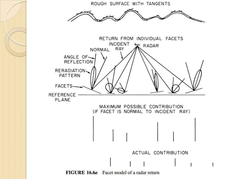
INTRODUCTION Radar ground echo: pantulan radar terhadap tanah perbedaan penghamburan bagian yang melintang atau disebut dengan koefesien penghamburan terhadap target yang berlainan. Relative Importance of Theory and Empiricism: Teori radar tanah yg tentunya melalui percobaan memberikan dasar untuk menilai efek dari keberagaman sifat dielektrik dari tanah, kekasaran tanah dan tumpukan salju terkait langsung dengan panjang gelombang radar dan sudut insiden. Pengukuran empiris diperlukan untuk menggabarkan kembali bentuk alam tadi dalam tampilan radar Available Scattering Information :

4
PARAMETERS AFFECTING GROUND RETURN Radar system parameters : - Wavelength - Power - lluminated area - Direction of illumination (both azimuth and elevation) - Polarization (including the full polarization matrix when available) Ground parameters: - Complex permittivity (conductivity and permittivity) - Roughness of surface - Inhomogeneity of subsurface or cover to depth where attenuation reduces waves to negligible amplitude
 - Polarization (including the full polarization matrix when available) Ground parameters: - Complex permittivity (conductivity and permittivity) - Roughness of surface - Inhomogeneity of subsurface or cover to depth where attenuation reduces waves to negligible amplitude")
5
THEORETICAL MODELS AND THEIR LIMITATIONS Descriptions of a Surface. Simplified Models Physical Optics Models Small-Perturbation and Two-Scale Models Bragg scattering

7
FADING OF GROUND ECHOES In fact, even fixed radars frequently observe fluctuations in ground echoes because of motions of vegetation, wires blowing in the wind, etc. This fluctuation is referred to as fading The statistics of the fading signal and the statistics of random noise are the same Fading-Rate Computations

9
Effect of Detection Moving-Target Surfaces. Near-Vertical Problem

10
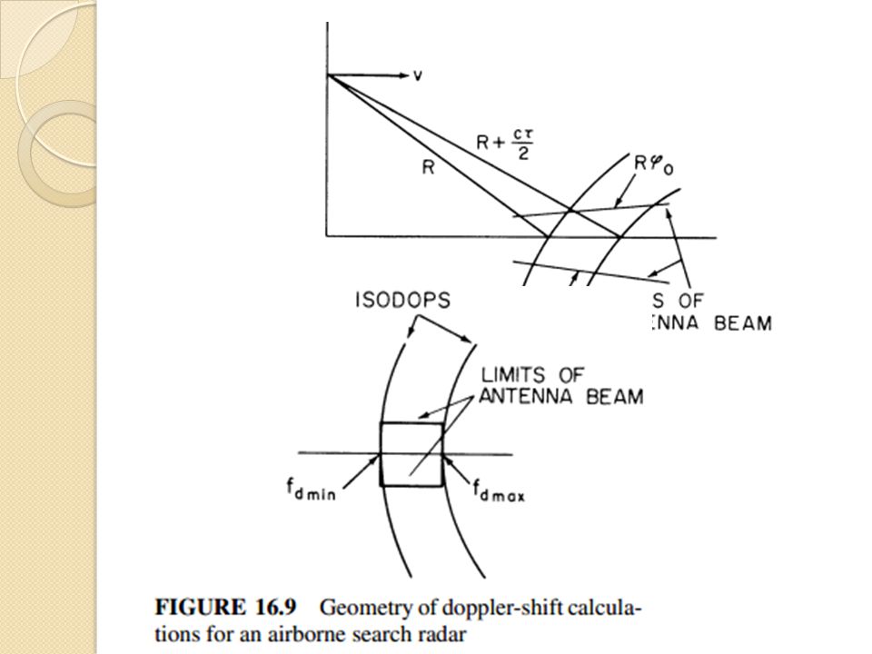
MEASUREMENT TECHNIQUES FOR GROUND RETURN Special-purpose instrumentation radars and modified standard radars may be used to determine the ground return. Since the ground return is almost invariably due to scatter-ing, these systems are termed scatterometers.

11
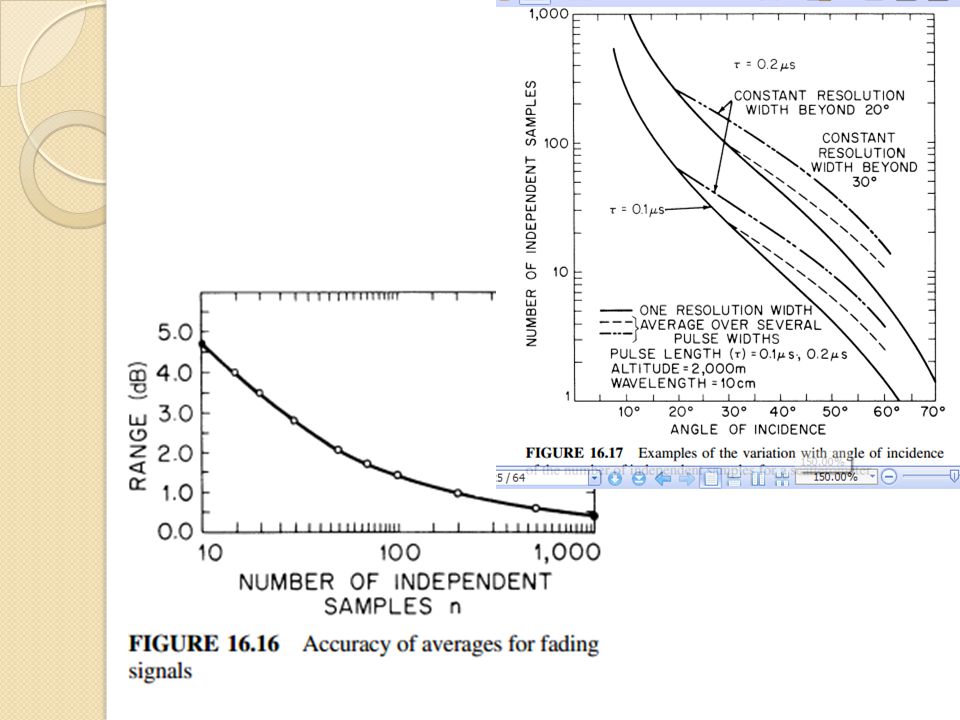
1) CW and FM-CW Systems. 2) Range-Measuring Systems 3) CW-Doppler Scatterometers 4) Independent Samples Required for Measurement Accuracy 5) Near-Vertical Problem 6) Ground and Helicopter Scatterometers and Spectrometers 7) Scattering Coefficients from Images
 Range-Measuring Systems 3) CW-Doppler Scatterometers 4) Independent Samples Required for Measurement Accuracy 5) Near-Vertical Problem 6) Ground and Helicopter Scatterometers and Spectrometers 7) Scattering Coefficients from Images.")
13
GENERAL MODELS FOR SCATTERING COEFFICIENT (CLUTTER MODELS)
")
14
SCATTERING COEFFICIENT DATA Effects of Roughness, Moisture Content, and Vegetation Cover Soil Moisture Vegetation. Snow. Sea Ice

15
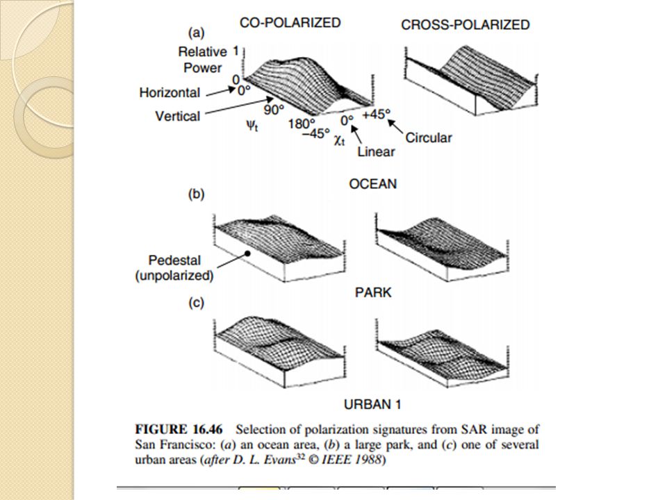
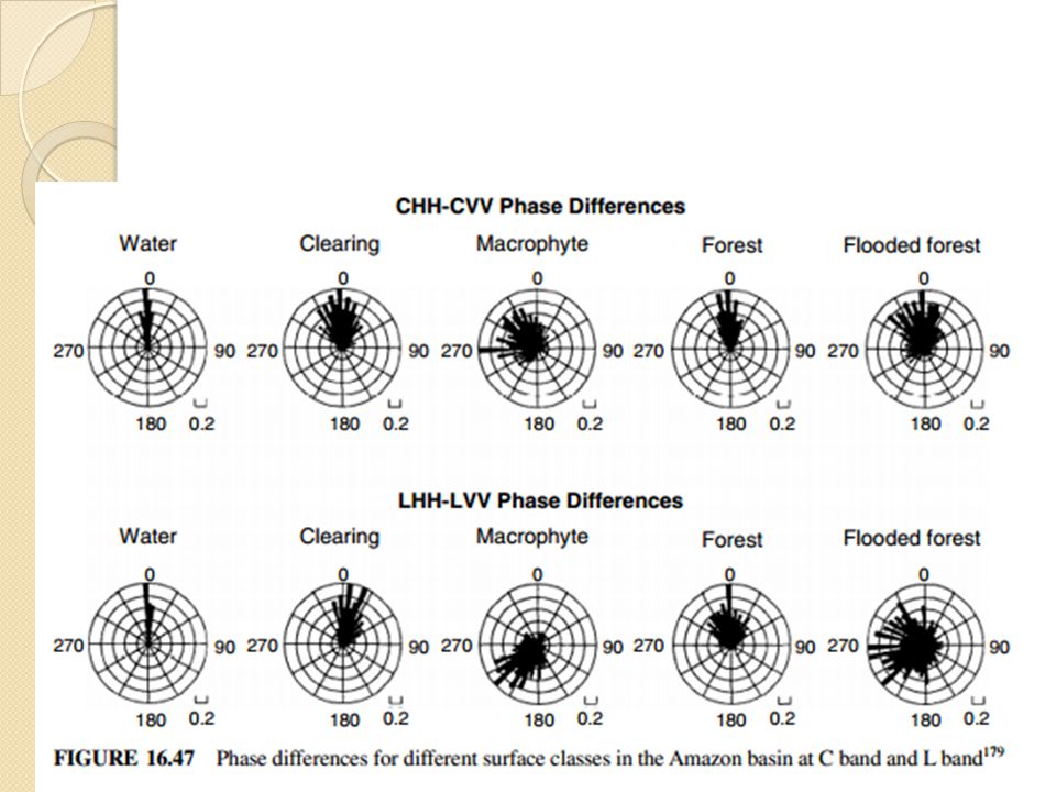
POLARIMETRY Several synthetic-aperture imaging radars are capable of measuring the full com-plex polarization matrix. Probably the first of these was an airborne system built by NASA’s Jet Propulsion Laboratory. The first one in space was the Shuttle Imaging Radar–C (SIR-C). Although use of multiple polarizations dates from the early days of imaging radars, the measurement of phase between the received signal with different polarizations is more recent, dating from the late 1980s. Few, if any, full-polarimetric data sets exist of the type described above for single polarizations.
. Although use of multiple polarizations dates from the early days of imaging radars, the measurement of phase between the received signal with different polarizations is more recent, dating from the late 1980s. Few, if any, full-polarimetric data sets exist of the type described above for single polarizations..")
17
SCATTERING COEFFICIENT DATA NEAR GRAZING Conditions for backscatter near grazing incidence are sufficiently different from those at steeper incidence that they must be described separately. Here, we draw upon the work of Billingsley. They collected data over a wide range of terrain and unlike most pre-vious near-grazing measurements, also collected extensive “ground- truth” information and accurately calibrated their radars. Moreover, these data were over a wide range of frequencies: VHF (167 MHz), UHF (435 MHz), L band (1.23 GHz), S band (3.24 GHz), and X band (9.2 GHz)
, UHF (435 MHz), L band (1.23 GHz), S band (3.24 GHz), and X band (9.2 GHz).")
19
IMAGING RADAR INTERPRETATION Resolusi pencitraan radar gambar terbaik didapat dengan cara manual atau buatan gambar yang dihasilkan mirip dari poto yang diambiil lewat udara, perbedaan dari kedua bayangan untuk bagian tanah menghasilkan variasi intensitas gambar dari poto tersebut juga berbeda, Oleh karenanya Foto Interpreter bisa dengan mudah dipelajari untuk menampikan gambar radar. Dulu Sejak gambar radar dihasilkan dari pemantulan microwave, tidak dengan pemantulan optik, interpreter harus bisa membedakan perbedaan panjang gelombang agar saling melengkapi. Distorsi geografis juga masuk ke sistem pencarian rentang pengukuran dimana poto yang diambil dari udara tadi dari sudut pengamatan bawah tentunya hasilnya berbeda. Dari sudut yang rendah distorsinya juga rendah diterima radar, tetapi pada sudut insiden rendah justru sebaliknya, Pencitraan radar terkini, menggunakan perekaman dan pemrosesan digital gambaranya dihasilkan pada film atau dimanipulasi secara digital. Konfigurasi Sisi pencitraan menghasikan gambar strip, keluaran dari film biasanya ada di strip yang pajang,

Presentasi serupa


>")
 signals ( pseudo-noise ) signals.>")


 Mata kuliah: K0194-Pemodelan Matematika Terapan Tahun: 2008.>")


>")

